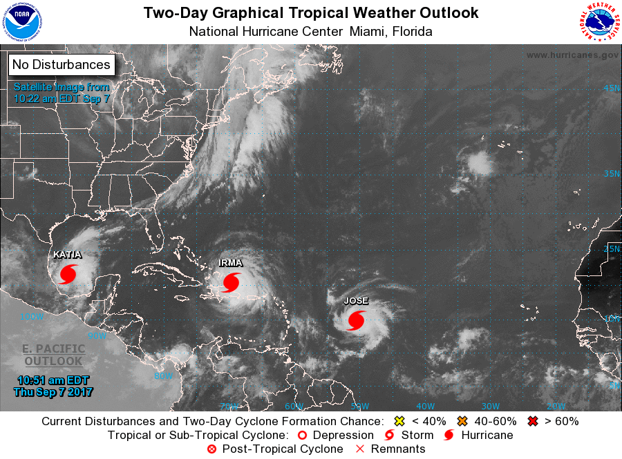
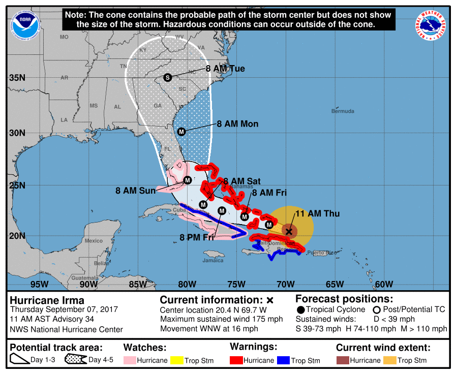
Irma is a potentially catastrophic category 5 hurricane and will continue to bring life-threatening wind, storm surge, and rainfall hazards to the northern coast of Hispaniola today. These hazards will spread across the Turks and Caicos tonight and the Bahamas tonight through Saturday.
A hurricane watch is in effect for much of Cuba. Irma is likely to bring dangerous wind, storm surge, and rainfall to portions of these areas on Friday and Saturday.
The threat of dangerous major hurricane impacts in Florida continues to increase. A hurricane watch has been issued for south Florida, the Florida Keys, Lake Okeechobee, and Florida Bay. This watch will likely be expanded northward later today. Residents in these areas should heed any advice given by local officials.
A storm surge watch has also been issued for portions of south Florida and the Florida Keys. This means there is the possibility of life-threatening inundation from rising water moving inland from the coastline during the next 48 hours in these areas. The Potential Storm Surge Flooding Map depicts a reasonable worst-case scenario – the amount of inundation that has a 10 percent chance of being exceeded. Because the Flooding Map is based on inputs that extend through 72 hours, it best represents the flooding potential in the watch area.
The chance of direct impacts is increasing in portions of Georgia, South Carolina, and North Carolina, but it is too early to specify the magnitude and location of the impacts.
Additionally, Hurricane Jose is expected to become a major hurricane by Friday, and Hurricane Katia is expected to begin moving toward the coast of Mexico on Thursday night or early Friday.
Information courtesy of the NOAA.