
By Kayleen Holder
Editor
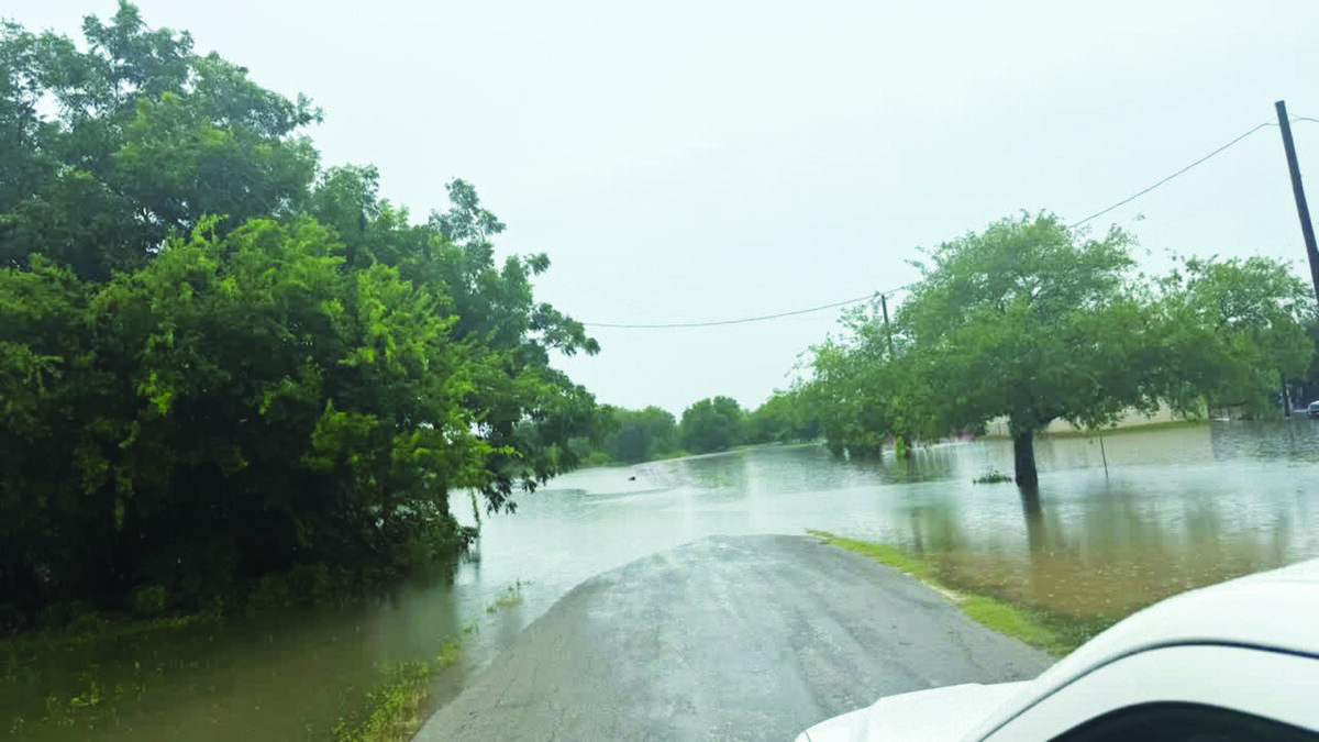
Many first responders in Medina County are already running on little to no sleep after downpours beginning Monday night led to multiple vehicles being swept off the road and over 30 road closures. Local officials are keeping a close eye on things as the National Weather Service is forecasting more rain–a lot more.
As of Tuesday around 1 pm, we haven’t seen anything catastrophic but forecasts have reporters from all over the nation calling local officials, they said.
As of Tuesday morning, we haven’t seen anything out of the ordinary, said Fire Chief Clint Cooke. “However, if we get another 10 inches tonight (Tuesday night), that’s going to be a problem,” Cooke added. “They are predicting we could get 20 inches over the next couple days. We’ll see.”
NWS has forcasted “Considerable to locally catastrophic flash flooding impacts likely in this region. Pockets of an additional 10-20 inches of rain in this region are possible. Storm totals across the rest of the area under the Flood Watch of 2 to 6 inches are possible.
We spoke to Medina County Emergency Manager Mark Chadwick about some of the water rescues and flooding that is occurring from Monday night and Tuesday morning rains.
“We’ve had four water rescues in the county,” Chadwick said.

“The first was on County Road 442 north of Hondo. There were two in that area. Then we had one at the intersection of CR 4516 and CR 365 in Quihi, and one at Medina Aggregates off Hwy 173 N, where a vehicle got washed away after a driver turned off of the highway and onto a private road.”
Thanks to quick action by first responders, everyone was okay. Parts of the county got as much as 9 inches.
“The majority of rain was south of Tarpley, north of Hondo, and east of Quihi,” Chadwick said. “We got as much as 7-9 inches.”
It came down quick.
“We got as much as 4-5 inches in one hour near the Medina Lake,” Chadwick said.
As of Tuesday morning around 10 am, there hadn’t been any reports of homes flooding.
“But we are watching and keeping a close eye on that in D’Hanis,” Chadwick said. “There’s water everywhere, but the worst is in the D’Hanis area.”
He noted that drivers are advised not to travel west on Hwy 90 as Department of Public Safety has shutdown Hwy 90 between Knippa and Sabinal, and as of Monday morning, they were considering extending that closure towards Medina County due to flooding.

Medina County Fire and EMS issued a public announcement stating “We continue to encourage limiting your travel to only necessary trips as we work through this.”
Storms wreaked havoc on power as well. Medina Electric had over a hundred outages across it’s service area impacting 2,882 meters since 5 pm yesterday (Monday July 13).
This number continues changing as more outages come in Tuesday morning.
“The biggest hurdle is floodwaters making it hard for us to access locations,” said Medina Electric rep Jackie Muennink, who noted Uvalde County was hit the hardest.
While everyone hopes we don’t see pockets of 20 inches this week in South Texas, it has happened before. A Devine News article from October of 1998, documents “torrential rains” that fell over a good portion of San Antonio estimated at 18-20 inches.
“Rescue crews made a phenomenal amount of rescues by boat, jet ski, and anything available,” the article says. The Devine area received as much as 10 inches during that same time frame that year.
CURRENT Medina County Road Closures as of Tuesday morning:
The following roads are impacted by water:
HWY 90 Shutoff Westbound Do not travel west on Hwy 90!
CR 111
CR 211
CR 232
CR 241
CR 251
CR 252
CR 271
CR 311
CR 331
CR 341
CR 342
CR 343
CR 351
CR 353
CR 365
CR 371
CR 381 at FM 471 N
CR 422 at the Parker Creek
CR 429 at the Seco Creek
CR 429 at brickyard in D’Hanis – water over the bridge
CR 433
CR 441
CR 442
CR 445
CR 446
CR 450
CR 451
CR 452
CR 455
CR 456
CR 512
CR 542
CR 2615
CR 4516 at
CR 4526
CR 4545
CR 5219
All roads in D’Hanis on southside of Hwy 90 have standing water
CONSTANTINOPLE
OLD RIVER RD
Parker Creek running heavy in downtown D’Hanis
Water running heavy in the Parker Creek downtown D’Hanis and just below the bridge on Hwy 90
Please stay at home unless you absolutely have to leave! Turn Around, Don’t Drown!
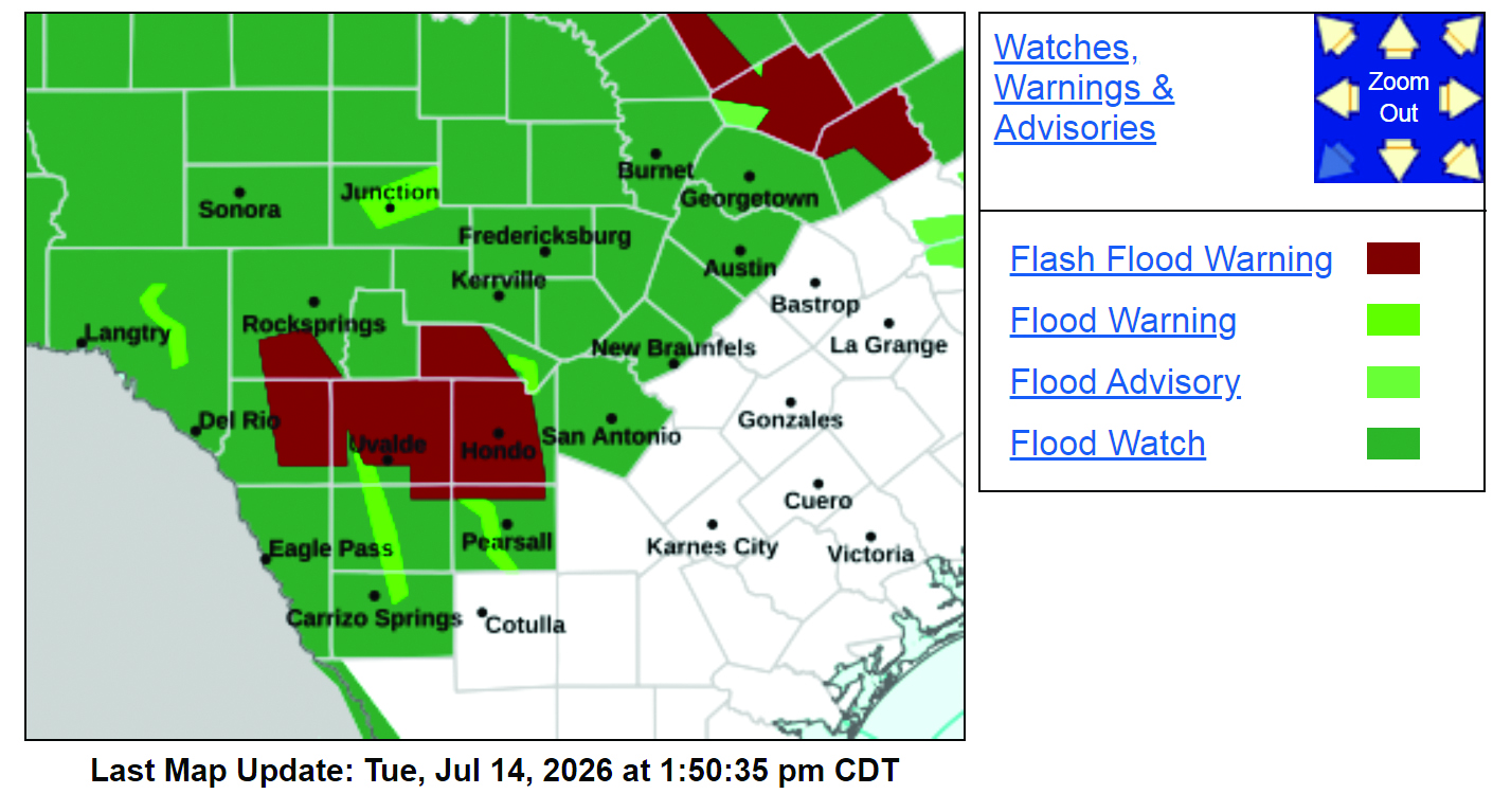
Between now and Thursday–NWS has forcasted “Considerable to locally catastrophic flash flooding impacts likely in this region. Pockets of an additional 10-20 inches of rain in this region are possible. Storm totals across the rest of the area under the Flood Watch of 2 to 6 inches are possible.